


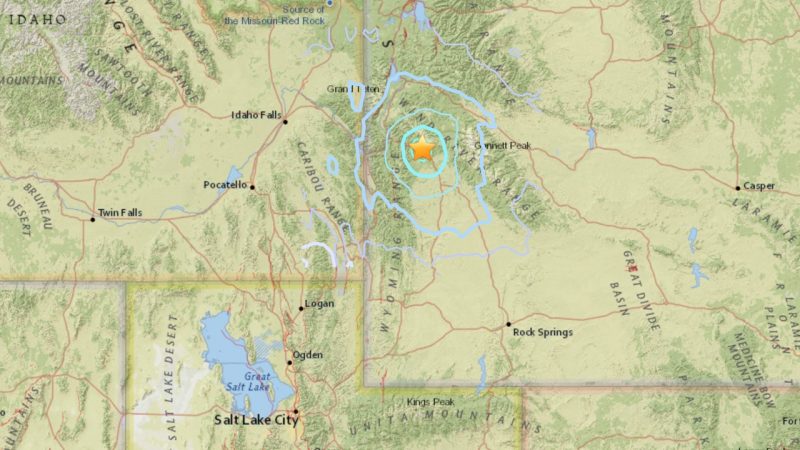
The U.S. Geological Survey (USGS) is reporting a 4.8-magnitude earthquake – an earthquake strong enough to be felt – 23 miles (38 km) east of Hoback, Wyoming. The quake took place at at 2:47 p.m. Mountain Daylight Time (2047 UTC; translate to your time zone).
The USGS provides details on the quake as follows:
Geographic coordinates: 43.230N, 110.313W
Magnitude: 4.8
Depth: 9 km
Universal Time (UTC): 27 Aug 2016 20:47:47
Time near the Epicenter: 27 Aug 2016 14:47:47
Location with respect to nearby cities:
38 km (23 mi) E of Hoback, Wyoming
136 km (84 mi) ESE of Rexburg, Idaho
136 km (84 mi) E of Ammon, Idaho
142 km (88 mi) E of Idaho Falls, Idaho
303 km (187 mi) NNE of Salt Lake City, Utah
4.8 Magnitude Earthquake has been felt by many people Saturday afternoon over Western Wyoming. pic.twitter.com/vgsYma3fs8
— KCWY News 13 (@KCWY13) August 27, 2016
Like what you read?
Subscribe and receive daily news delivered to your inbox.
More from
Deborah Byrd


