


In the span of 141 years of climate records, there has never been a warmer January than last month, according a report released on February 13, 2020, by scientists at NOAA’s National Centers for Environmental Information. The previous record-hottest January was in 2016.
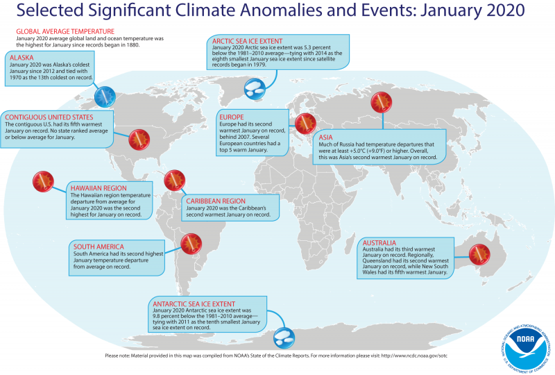
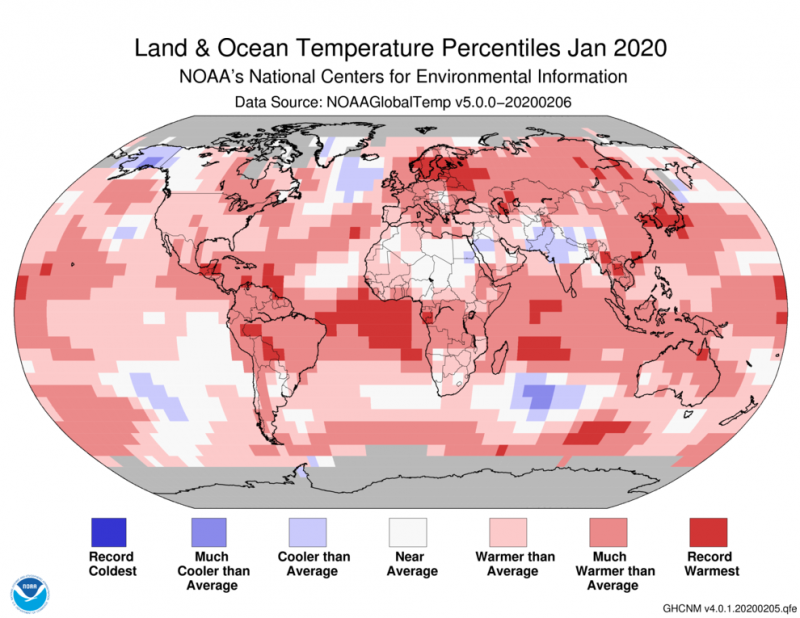
According to the NOAA data, the average global land and ocean surface temperature last month was 2.5 degree Fahrenheit (1.14 degrees Celsius) above the 20th-century average. January 2020 marked the 44th consecutive January and the 421st consecutive month with temperatures above the 20th-century average.
In the entire NOAA climate record, which began in 1880, the four warmest Januaries have occurred since 2016; while the 10 warmest Januaries have all occurred since 2002.
Last month showed record-warm January surface temperatures across parts of Scandinavia, Asia, the Indian Ocean, the central and western Pacific Ocean, the Atlantic Ocean and Central and South America. No land or ocean areas had record-cold January temperatures.
For a more complete summary of climate conditions and events, see NOAA’s January 2020 Global Climate Report.
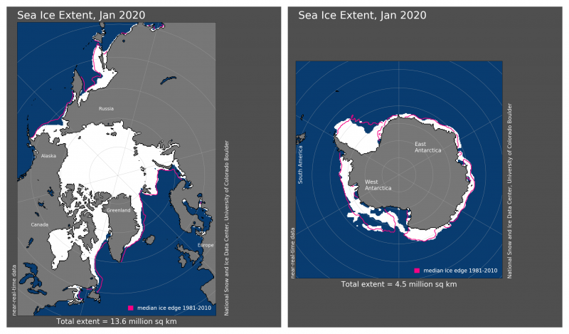
NOAA also reported on Earth’s sea ice cover for last month. Sea ice is simply frozen ocean water. It forms, grows, and melts in the ocean. In contrast, icebergs, glaciers, ice sheets, and ice shelves all originate on land. NOAA said:
The January 2020 average Arctic sea ice extent of 5.27 million square miles (13.6 square km) was 297,000 square miles (770,000 square km) – 5.3 percent – below the 1981–2010 average, tying with 2014 as the eighth smallest January extent in the 42-year record.
Antarctic sea ice extent during January was 1.74 million square miles (4.5 million square km), which is 190,000 square miles (490,000 square km) – 9.8 percent – below the 1981–2010 average. This value tied with January 2011 as the 10th smallest January sea ice extent on record.
You can read the complete January 2020 Global Climate Report here.
Bottom line: January 2020 was Earth’s hottest January in the climate record.
Like what you read?
Subscribe and receive daily news delivered to your inbox.
More from
Eleanor Imster


