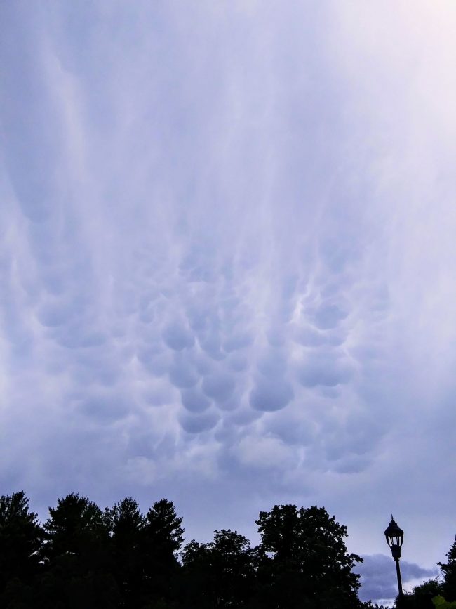
Mammatus clouds are pouch-like protrusions hanging from the undersides of clouds. You’ll usually find them under thunderstorm anvil clouds. But you might see them under other types of clouds as well. They’re composed primarily of ices, and groups of them can extend hundreds of miles in any direction. But they’re fleeting, remaining visible in your local sky for perhaps 10 or 15 minutes at a time.
People associate these cloud pouches with severe weather. And it’s true; they typically appear around, before or after a storm.
In fact, most clouds are formed by rising air. But mammatus clouds are interesting in part because they’re formed by sinking air. And you sometimes hear people say that mammatus clouds continue extending downward and can even form tornados, but that’s not true.
They appear ominous. And they do signify storms. But, in a way that’s so common in nature, their dangerous aspect goes hand-in-hand with a magnificent beauty.
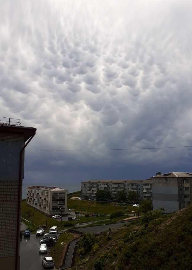
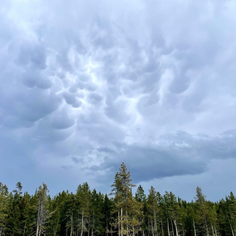
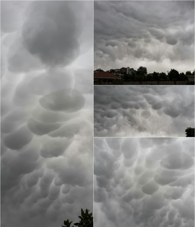
View at EarthSky Community Photos. | Filipp Romanov in Yuzhno-Morskoy, Russia, captured these mammatus clouds on June 4, 2023. Thank you, Filipp!EarthSky’s Kelly Kizer Whitt shared this photo of mammatus clouds from Colter Bay in Grand Teton National Park on May 30, 2023.
Mammatus clouds from 2022
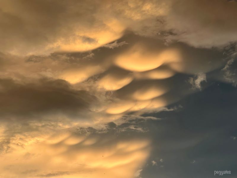
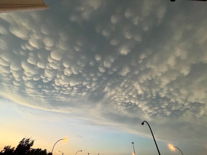
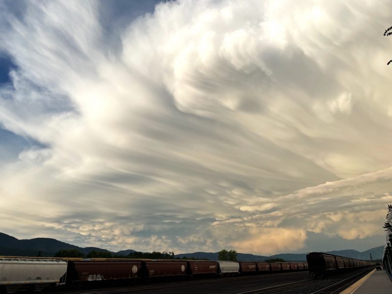
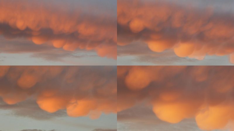
View at EarthSky Community Photos. | Peg Yates in Woodbridge, Virginia, took this image on August 22, 2022. Peg wrote: “Mammatus clouds in the western sky when the sun was setting.” Thank you, Peg!View at EarthSky Community Photos. | Michael Geib caught these mammatus clouds from Akron, Ohio, on July 20, 2022. Thank you, Michael!Mammatus clouds from Kelly Kizer Whitt at the Amtrak station in Whitefish, Montana, on July 7, 2022. See the mammatus clouds on the far underside of the storm? Image via Kelly Kizer Whitt.
Mammatus clouds from 2021
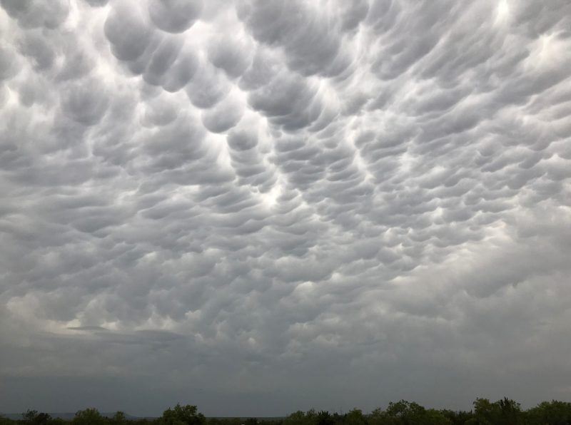
Steve Schultz in Ashville, North Carolina, sent this photograph of mammatus clouds on June 20, 2021. Thank you, Steve!
Mammatus clouds from 2020
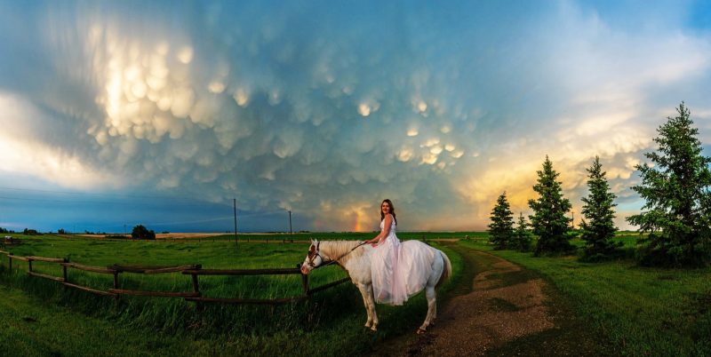
View larger at EarthSky Community Photos. | Christy Turner caught this photo of graduate Cheyann on June 13, 2020, from Calgary, Alberta, Canada. Christy wrote: “Incredible mammatus clouds and a rainbow help complete a graduation photo shoot. Since Cheyann didn’t get a proper occasion to wear her beautiful graduation gown, we scheduled a photo shoot at her grandparent’s farm. What we didn’t count on was nature delivering up an incredible backdrop post-storm.” Thanks, Christy!View at EarthSky Community Photos. | Marlane Burns captured this image on May 15, 2020, near Robert Lee, Texas. She said: “Mammatus clouds preceding a northern thunderstorm that came out of nowhere! The wind blew the flies away and the rain settled the dust!”View at EarthSky Community Photos. | Adelina Bathorja in Tirane, Albania, captured these clouds on May 14, 2020. Adelina wrote: “For the first time ever I saw mammatus clouds. Just, wow! It was a spectacular view of cellular and jellyfish patterns.”View at EarthSky Community Photos. | Peter Lowenstein captured these spectacular mammatus clouds in Mutare, Zimbabwe, on March 23, 2020. He wrote: “I took an early morning walk in the hope of catching a glimpse of the old moon rising. Instead there was a surprise appearance of mammatus clouds on the underside of a sunrise-illuminated band of altostratus cloud above.”
Bottom line: Mammatus clouds are bubbly-looking, low-hanging clouds often associated with thunderstorms. Learn more about them here and see photos.
Deborah Byrd created the EarthSky radio series in 1991 and founded EarthSky.org in 1994. Prior to that, she had worked for the University of Texas McDonald Observatory since 1976, and created and produced their Star Date radio series. Today, she serves as Editor-in-Chief of this website. She has won a galaxy of awards from the broadcasting and science communities, including having an asteroid named 3505 Byrd in her honor. In 2020, she won the Education Prize from the American Astronomical Society, the largest organization of professional astronomers in North America. A science communicator and educator since 1976, Byrd believes in science as a force for good in the world and a vital tool for the 21st century. "Being an EarthSky editor is like hosting a big global party for cool nature-lovers," she says.
Like what you read? Subscribe and receive daily news delivered to your inbox.
Thank you! Your submission has been received!
Oops! Something went wrong while submitting the form.